Институт геоэкологии им. Е.М. Сергеева РАН
LANDSLIDE HAZARD CRITERIA FOR TRANSPORTATION SAFETY OF THE 2014 OLYMPICS IN SOCHI.
Andrey Kazeev, German Postoev, Ksenia Fedotova // 14th GeoConference on Science and Technologies in Geology, Exploration and Mining. Conference Proceedings. Volume II. (International Multidisciplinary scientific GeoConference; 17-26 June, 2014, Bulgaria). Pp. 567-572. Читать…
!!! При КОПИРОВАНИИ материалов статей — НЕОБХОДИМО ИСПОЛЬЗОВАТЬ библиографические ССЫЛКИ на Статьи !!!
ABSTRACT
In preparation for the 2014 Winter Olympics in Sochi, a new road that combine highway with railway was constructed between Adler and Krasnaya Polyana. The combined road further goes on to the Alpika-Servis train station. It passes the valley of the river Mzymta. It is one of the most important objects in transportation infrastructure for the 2014 Olympics in Sochi. Olympic structures such as ski jumps, alpine skiing tracks and etc. are situated in the mountainous part of Sochi.
The goal of our study was to identify monitoring technologies and criteria for landslide hazard assessment for effective early-warning monitoring of the combined road. The aim of this monitoring system is to support the transportation safety for the 2014 Olympics in Sochi.
The results of the research have shown that as primary monitoring instrumentations should be used horizontal extensometers and inclinometers. They provide the highest accuracy of landslide deformation measurements. The criteria for landslide hazard assessment were developed on basis of 2010-2013 monitoring results. Mechanisms of landslides in the region have also been taken into account.
Keywords: landslide hazard, early-warning monitoring, geotechnical instrumentation, Sochi.
INTRODUCTION
Landslides are one of the most widespread geomechanical processes.
The mitigational problem from landslides on the one hand concerns building in landslide-prone areas and on the other hand concerns providing an advanced warning about an activation of landslides which threaten the buildings.
The complexity of this problem is compounded by a large number of different types of landslides, their occurrence along the slopes and the developmental dynamics during the landslide progression (from the formation or activation phase and to the catastrophic destruction phase)
SITE CONDITIONS
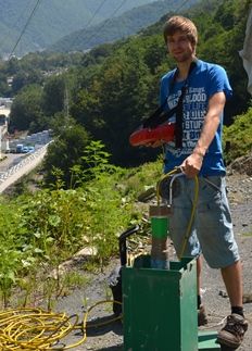
The landslide hazard is the main geologic hazard along the combined road from Adler to Krasnaya Polyana. The largest part of the area along the road is landslide-prone area and numerous landslides historically occurred on the bank slopes. At present, monitoring systems are installed at a number of Olympic structures, as well as they were used during constructing the roads. They include an automatic monitoring of main parameters which characterize the state of the landslide area at each moment.
Numerous factors contribute to such an active development of landslides in the region, such as a high degree of bedrock weathering on slopes. Abundant rainfalls and saturation of cover sediments also lead to the formation of numerous cracks and sliding.
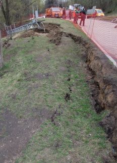
Nine landslide sites have been detected along the route of the combined road during geological investigations (Fig. 1).
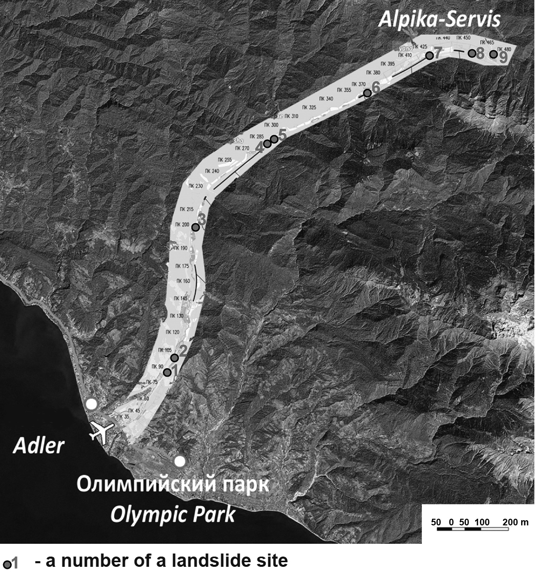
Fig.1. The location of landslide sites along the combined road from Adler to Alpika-Service.
It was determined that the most widespread type of landslides within the study area is a debris slide. Several sites, especially ones at the beginning of the route, exhibited block-type landslides of compression-extrusion.
METHODOLOGY
A number of approaches for landslide hazard assessment have been considered during the research.
Stability analyses (Fs) of a slope are one of the most common approaches for assessment of a limit-equilibrium state. It is accepted that in a limiting state the Safety Factor is equal to one (Fs=1), when the sliding occurs. So for the moment of the beginning of deformations the calculation must show that the sum of shifting forces is equal to the sum of resisting forces.
As rule, the calculations are carried out for slopes where the possibility of a landslide formation exists. On such slopes the conditions of static equilibrium are considered.
So, once the soil movement begins, the slope is considered to be in a dynamic state (Fs<1). For instance, stability analyses have no sense at sites that reveal signs of recent landslide displacements, such as cracks, specific geomorphologic elements (steps, bulging shafts, etc.), because it’s obvious that Fs<1.
Geophysical methods could be used for further characterization of a soil massif state. Electro- and seismic methods, seismoacoustic (geoacoustic) measurements, observations of natural electromagnetic emissions, georadiolocations (georadar) and others [1-3] are applied.
There are known studies that propose to use geophysical methods to receive indications of the beginning of a landslide process, which can further be used as criteria of a landslide hazard. Such studies were carried out at underground objects and open mines, mainly to control the stability of pit edges [1].
Detailed studies of a large variety of geophysical methods were carried out during the in-situ experiment on artificial activation of landslides in Zhukovka and Stavlukhar (Ukraine) [2]. The results of these studies showed that the application of geophysical methods is ineffective for the determination of an active landslide state and for identification of dangerous stage occurrence of a landslide.
Geophysical methods were also used to specify the geological cross-section of the studied massif, its structure.
Critical deformations. Instrumental observations of soil massif deformations (starting from the stable state and to catastrophic destruction) allow establishing critical values of slope movements. Such investigations were carried out in laboratory conditions, simulating critical shear deformation for different soil types and also for natural slopes.
Professor Demin A.M. has analyzed more than 400 cases of large landslides in open pits in Russia and other countries and has compiled data of instrumental observations [4]. He proposed to use two parameters for the determination of a slope stability in open pits: — vertical (h/H) and horizontal (l/L) relative deformations of an upper part (platform) of a slope. Herein, h and l — vertical and horizontal values of a displacement along crack, and H and L — a height and a length of a slope.
This approach for a landslide hazard assessment is justifiable within areas along pit edges, where the initial stable state of a slope is known. Furthermore, this state changes along with a change of slope geometry during progressive landslide development, a change of slope profile and while its undercutting.
Deformation measuring along a slope with the use of mine surveying instrumentation can reveal approaching of a critical condition based on selected criteria (h/H) and (l/L).
However, different types of landslides may occur and be superimposed in case of natural slopes at different stages of slope development. In this case, instrumental observations could begin at an intermediate stage of a landslide process development. Therefore, the characterization of critical state by setting certain values of sliding-related parameters is very difficult.
Critical speed of displacement. The mode of a landslide deformation development in time, the critical displacement values and the speed of sliding differ a lot depending on a type of landslide, real geological conditions, a size and a stage of development of a landslide.
Any sudden increase in the driving force caused by changes of slope conditions (e.g., an abnormal influence of any factor) can trigger an accelerated progressive development of a landslide in a short time frame (from minutes to several hours) during the period of an active landslide development. It can cause the critical velocity of sliding, catastrophic destruction and the development of a dangerous situation within the landslide area.
It is generally accepted in open pit mining, that critical velocity of the displacement should be 3-4 times higher than the value of a steady-state creep velocity. However, the latter can change very much for different settings. For example, in the cross-section «Kumertauskii» (Bashkortostan) the rate of a steady-state creep was 9 mm/day; on landslide slopes in Kyrgyzstan — 15-20 mm/day; on the working pit edge of the Angren section (Uzbekistan) — 20 mm/day [5].
A significant activation of landslide movements was achieved by technogenic impacts on the landslide mass during the above-referenced in-situ experiment on artificial re-activation of the Stavlukhar landslide (the Crimea) in 1982. The initial displacement rate was below 10-30 cm/month prior to the experiment (based on geophysical data), increasing up to 3-10mm/day – for the lower part of the slope with the maximum rate in spring. The velocity has increased up to 75 mm/day after the technogenic impact (particularly due to the undercutting of the slope toe). The continuous monitoring of landslide displacements has been carried out with the use of extensometric points and arrays (deep rappers and crack meters).
The fact that the catastrophic landslide displacement have not been reached was perhaps because the activation of the landslide process have not spread upwards the slope. Even the back part of the lower block was substantially less active than the front part near the cutting trench.
Thus, the displacement velocity describes the state of a landslide during the sliding. However, the increase of the displacement velocity of a landslide (or of its parts) to high values (>70 mm/day) could not sometimes result in a catastrophic destruction as have been shown by the results of observations of landslide movements in a long-term on natural slopes, and on slopes with artificial landslide activations.
It is known that the soil strength is being reduced to a residual value during the process of soil deformation. Moreover, periodic activations of existing landslides lead to the formation of a specific hydrated layer (friction clay) along the sliding surface [5]. This layer stabilizes the soil shear strength on the residual level, which a little depends on initial soil strength.
This friction clay is often found along the sliding surface even in rocks. It can reach up to tens of centimeters in thickness [6]. This particular clay layer is prone for the creeping.
Thus, the soil shear strength along the sliding surface is a weakly variable parameter of a landslide, and therefore the state of a landslide cannot be linked with possible changes of parameters of soil strength («c» and «φ»). They cannot be useful in determination of the safety criteria.
The investigations have shown that on landslide slopes with relatively long-time displacements and with periodic changes in displacement conditions, the acceleration of a displacement velocity up to hazardous levels may lead to the initiation of the sliding in new areas near upper and side borders of an active landslide. This increase of the size of a landslide can result in a catastrophic destruction.
CONCLUSIONS
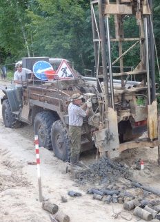
Two general methods of observations were accepted in the automatic monitoring system, set along the combined highway and railway: 1) extensometric arrays (providing automatic measurements of displacements over the surface of a landslide prone slopes), and 2) inclinometric measurement in drills (supplying measurements of sliding parameters vs depth, some in manual and automatic modes).
Thus, the results of our investigations have shown that the most useful parameters related to the characterization of an active landslide state and sliding dynamics, including the progressing development of a landslide during activation, are: landslide displacement velocity, depths of slip surfaces and propagation of active displacements within the territory.
Landslide hazard criteria were proposed for the constructions of the road based on the monitoring data of an active landslide at one of the study sites along the railway from Adler to Krasnaya Polyana. These criteria are based on measurements of displacement velocities and distribution of landslide deformations (including new volumes of ground masses involved along the margins of active landslides) with area and depth.
As a result, several monitoring methods as related to the landslide hazard were recommended along the Adler-Krasnaya Polyana railway:
- automatic observations of displacements over the slope surface using extensometers;
- inclinometers (during site visits and in partly automatic mode).
The following landslide safety criteria were recommended based on the rate of movement (V) of the control points:
- V<4 mm/day — SAFE (green signal);
- 4≤V<24 mm/day — DANGEROUS CONDITION (yellow);
- V≥24 mm/day — VERY DANGEROUS CONDITION (red signal).
Furthermore, the control for landslides is being provided over the area and the depth.
References
[1] Lukyanov A.N., Ioffe A.M., Klimenko A.I. Methods of control of slope stability at «Muruntau» pit // Mining journal. Russia. 1997. № 1. Pp. 30-32.
[2] Postoev G.P., Erysh I.F., Salomatin V.N. and others. Artificial activation of landslides. Russia. M: Nedra, 1989. 134 p.
[3] Monahov V.V., Ovchinnikov V.I., Urusova A.V. Opportunities and the prospect of application of geophysical methods for diagnostics of railways // Modern problems of projection, construction and exploration of railways and structures. Proceedings of the second scientific-technical conf. M.: MSU of railway engineering (MIIT). Russia. 2005. Pp. 76-78.
[4] Demin A.M. Assessment of landslide hazard by critical deformations // Proceedings of the jubilee conference, on the 50th anniversary of ROMGGIF «Russian geotechnics — step into the 21st century» Moscow, 15-16 March 2007. M: ROMGGIF. Russia. 2007. V-2. Pp. 324-328.
[5] Pushkarev V.I., Kolesatova O.S. Assessment and control of deforming pit edges of the pit «Yubileyny» // Mining information-analytical Bulletin. Russia. 2004. № 9. Pp. 278-282.
[6] Gulakyan K.A., Kuntcel V.V., Postoev G.P. The mechanism and dynamics of the landslide process on the example of the landslide in Zeravshan valley // Materials of the scientific-practical meeting on methods and forecast of debris flows, avalanches, and landslides. Dushanbe. 1970. Pp. 59-65.
Наши услуги
Фотогалерея
Наши Партнёры